

On 7 December 1972 at 11:39 a.m. Spanish time, the shutter of a Hasselblad 70 millimetre camera opened and closed in an instant. What made that photograph special, compared to the thousands of others taken that day, was not the camera, nor the moment, but the place where it was taken. In the instant that the shutter blinked, a huge ball of blue, white, green and brown on a black background was fixed on the photosensitive film on the other side of the lens. The image, later named “The Big Blue Marble”, was taken by crew members aboard the Apollo 17 mission, 29,000 kilometres above the surface, and shows the illuminated face of the Earth floating in the vastness of space. It has become one of the most publicised images in history. Not surprisingly, it perfectly captures the essence of our home.
As impressive as the feat is, an image of the Earth is of little use, as it only tells a small part of the story - the part we can see. In the 50 years since that photograph, there has been a real revolution in the systems dedicated to observing our planet. This is the case, for example, with the emergence of new technologies that transcend what we can detect with our eyes and provide otherwise invisible information. These technologies embedded in satellites and drones offer us a completely new vision, collecting huge amounts of data from all over the world, even in regions that are difficult to access.
In addition to collecting these data, it is their analysis by computers, millions of times more powerful than the ones that took humans to the moon, that allows us to predict, as if they were an oracle, the most likely scenarios of evolution. In this way, we can test climate models, detect large migrations of birds and insects, or prevent and manage natural hazards such as floods, fires, earthquakes or landslides.
Since we took the image of the big blue marble, We have never stopped observing our planet. However, a once much more artistic enterprise has now been replaced by analytical eyes, which allow us to extract whatever information we can use to understand our impact on the Earth, and to act accordingly. Humanity now monitors the health of the environment, and uses satellite data for scenarios as diverse as water resource management and precision agriculture.
INSIDE. The new maps of the Earth beyond the visible
In ancient times, manual cartography accompanied the progress of mankind and enabled it to know the environment in which it moved. By capturing reality on a map, humans had a great advantage both in the war environment and in the age of exploration. But these maps were always created from an observation point on the ground, allowing only a partial view of the environment. It was not until 1783 that humans began to take to the skies with the development of balloons, and it was not until the 20th century that we were able to do so with aeroplanes. This fact, in addition to revolutionising transport, also allowed us to raise our instruments and see, with cameras of all kinds, the world as never before.
Parallel to this development, other scientific fields such as physics and optics had also been advancing. Machines have been developed with which to measure beyond what our eyes can detect. This is the case of infrared cameras, radar and, later, LIDARs, which use other wavelengths outside the visible spectrum. Thus, science was served. The combination of aircraft and measurement methods gave rise to photogrammetry and aerial measurements, which made it possible to study and precisely define the shape, dimensions and position of an object or phenomenon in order to predict its future.
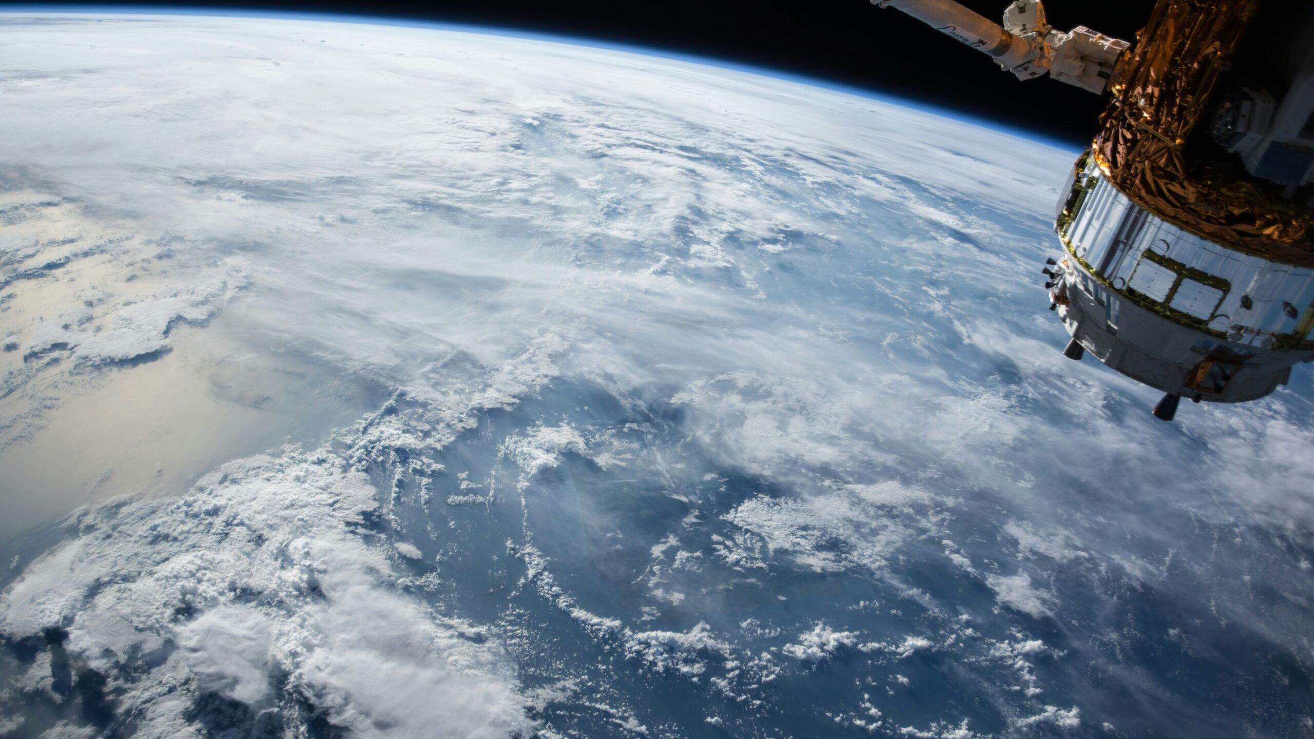
The next leap in technology began with the launch of the satellite Sputnik-1 in 1957 by the Soviet Union. This event, which ushered in the space age, demonstrated that humanity had the ability to escape from its planet, opening up not a world, but a universe of possibilities. With the breaking of the final frontier, scientific instruments began to be sent into space to measure various terrestrial phenomena.
One of the most famous is the Landsat system.[1] developed by the United States. The project, which began with the launch of the first satellite in 1972, has focused on observing the Earth in different spectra and has provided a wide range of data for a number of sometimes surprising uses. For example, one of the first agencies interested in this technology was the US Department of Agriculture for space-based pest monitoring. Although Landsat 1 only had a resolution of 80 metres, it was able to detect the amount of vegetation in fields and which ones were being affected by fungi or insects. This allowed containment plans to be drawn up and total yields to be predicted.
In the following 50 years, considerable progress has been made in both the resolution of scientific instruments and the number of satellites orbiting our planet, resulting in greater data collection and measurement accuracy. Figure 1 reviews the presence of geospatial data collection means by altitude. The latest Landsat satellite, Landsat 9[2] was launched in 2021, and takes 1,400 images a day of the Earth at a resolution of 30 metres. In this way, the evolution of phenomena such as fires, algae growth, the state of reservoirs, or the health of ecosystems can be monitored. The data collected by Landsat are free to use for research, which has enabled the scientific community to generate nearly 20,000 articles on various topics. There are dozens of satellites that are part of other constellations (such as the Sentinel satellites of the Copernicus programme, or the MODIS and VIIRS satellites, which specialise in wildfires).[3]).
High-resolution multispectral imaging and continuous monitoring have generated time series that show the changes that have occurred over the last 50 years.[4] we have been focusing on our planet. Thanks to these records we have been able to see the drying up of the Aral Sea, the advance of the Sahara desert, or the loss of the Amazon rainforest. But also how recovery measures have affected the partial filling of the sea, progress in the defence of the rainforest or the great green wall of the Sahel south of the Sahara.
But using satellite imagery locally sometimes does not provide the resolution needed for many tasks. As Figure 2 shows, not all technologies are equally optimal in all circumstances. To this end, the last decade has seen a large growth in the supply of both autonomous and radio-controlled drones that mount miniature multispectral cameras for precision monitoring. Drones are used in construction, civil engineering, agriculture, environment, mining and even archaeology. They help to draw up work plans based on a thorough knowledge of the environment with which to increase efficiency or sustainability.
According to data from the Union of Concerned Scientists[5] (updated in February 2024), it is estimated that there are more than 1,250 Earth observation satellites in civil, governmental, military or commercial orbit. The vast majority of these are in low orbit (between 500 and 2,000 kilometres altitude), but there are also some in higher orbits. A high percentage of these satellites are in constellations to cover a large part of the globe in real time.
In Europe, the Sentinel constellation stands out.[6] ESA's new satellites (10 by December 2025) are specialised in different tasks:
- Sentinel 1 (A, B and C) acquire radar images that are very useful for tracking changes in the height of a terrain, as well as possible structural damage caused by them. By making such observations systematically, Sentinel 1 is able to detect and monitor movements that would otherwise be imperceptible, such as the buckling of the ground that occurs on some volcanoes days before they erupt. These satellites are therefore used for landslide forecasting and monitoring of geologically active areas. They are also used for monitoring land over mines, as well as in agriculture, forestry or land cover classifications.
- Sentinel 2 is equipped with a multispectral instrument that can detect 13 different wavelengths (four with 10-metre resolution, six with 20-metre resolution and three with 60-metre resolution). Researchers have merged their data with those from the Landsat 8 and 9 satellites (both currently active) to create the Sentinel-2 Landsat Harmonised Data Set, which is public and free to use for research.
- In the case of Sentinel 3, with its instruments measuring sea surface topography, sea and land surface temperature, and ocean and land surface colour, it monitors the environment and climate effects with high accuracy. It is also used to verify data on ocean forecasts, fires, river and lake water, polar and glacier ice thickness, and the atmosphere. Its data allow the resolution of ERS, ENVISAT and SPOT satellites to be increased.
- Sentinel 5, on the other hand, specialises in observing air quality, stratospheric ozone and monitoring the effects of climate change. It is therefore a very useful satellite for public health, as there is a link between air quality and the development of lung and cardiovascular diseases. In addition, its ability to observe cloud formation is also vital for predicting electricity generation by solar panels.
Other countries, such as the United States, China and Russia have their own observation satellite networks. Some of them disseminate open-access data to cover more precisely the same areas of interest as Sentinel. Others have closed systems for commercial, governmental or military use.
In the last decade, drones have burst onto the scene like an elephant in a china shop to change the paradigm in Earth observation. These vehicles, instead of being hundreds of kilometres above the surface, fly much closer to the ground, making it possible to obtain a much higher resolution of the terrain. Drones can be fitted with optical cameras, thermal cameras, radar, LIDAR and many other observation devices that, while not as complete and durable as satellites, cost several orders of magnitude less and require less equipment and expertise to set up.
Drones are also a more flexible technology than satellites. Some of them have modular components and their use can be adapted to the needs. They are therefore very useful in risk management, from early detection of fires using thermal cameras to monitoring landslides after floods. They can also be used to send messages to people at risk and to indicate the safest evacuation routes.
Today, drones are becoming increasingly important in agriculture. In the same way that satellites can detect fields affected by pests, drone observation campaigns can detect individual plants affected by diseases or differences in the distribution of water and nutrients. However, it is undoubtedly the synergy between the data from both technologies that allows for the best results.
Cameras and detectors take information from the ground and transform it into a language that can be worked with. But with the increase in the number of drones and satellites, the amount of data for analysis is also growing, and changes, sometimes subtle, can escape human capabilities. As a result, big data, machine learning and artificial intelligence platforms have been developed that allow the first pre-analyses and even complete data analyses to be carried out to make them understandable to humans.[7].
In this sense, deep neural networks have been a turning point in the identification of patterns and anomalies. Thanks to them, it has been possible to establish algorithms for the automatic detection of forest fires or changes in land use quickly and accurately.
However, there is some division in the scientific community on how to deal with this data. On the one hand, there are those who think that deep learning should be adopted for everything, and on the other hand, researchers who are reluctant to adopt such solutions because it is a «black box» model in which you know what data you are inputting, but you cannot follow all the steps of its processing. As a result, artefacts may appear that artificial intelligences, or the humans supervising them, could misinterpret.[8].
Where a large number of scientists do converge is in their commitment to collaborative and open source platforms, such as Google Earth Engine.[9]. On these platforms, astronomers and data scientists create and update powerful satellite data processing tools for use by the entire community. The platform also contains several petabytes of freely and openly accessible data for research purposes. In this way, everyone can access this data and analyse trends and risks from anywhere on the planet.
Half a century of Earth observation has seen tremendous progress, but with some risks and new challenges. Among them, ESA points out that the lack of certification and standardisation of processed data makes it difficult to analyse and use them. Therefore, closer collaboration between the different space agencies could lead to a breakthrough in the amount of data available with the same resources. On the other hand, the chain of custody of the data must be well defined and monitored by external actors to ensure that the data are kept intact from start to finish. In addition, it is necessary to ensure that the data collected are private and do not infringe on the individual rights of individuals.
That said, satellites and drones can be a powerful tool for obtaining ground-based information from areas that are restricted by existing laws or for national security reasons. Using the imagery obtained, it is possible to ensure that the 17 Sustainable Development Goals set by the UN for 2030 are being met.[10], The images can provide objective evidence in international courts of law to prove violations of human rights, both civil and political, economic, social and cultural rights in countries where information on the ground may be contradictory. In addition, such images can provide objective evidence in international courts of law to prove human rights violations.[11] that may be being committed.
Ultimately, the use of artificial intelligence and the integration of increasingly advanced sensor data, both in drones and satellites, opens up new possibilities for anticipating and mitigating future risks related to climate change or other human actions. As such, international collaboration and open access to data and technologies are expected to continue to drive innovation in this field, enabling communities around the world to improve their resilience to disasters and extreme events.
Earth observation has ultimately evolved from a rather artistic endeavour to a precision science. Advances in drones, satellites and data analysis tools have allowed humankind not only to contemplate its planet, but also to understand it in depth and use this knowledge to anticipate natural and human risks more efficiently. The next steps require synergy between these systems and data processing, and AI and open access data platforms will play a crucial role in the future.
With these technologies, emergency services will be able to strengthen their response capacity and make informed decisions in areas as diverse as environmental management, agriculture, public health and human rights advocacy. However, this progress brings with it new ethical, legal and data management challenges, requiring greater international cooperation and a firm commitment to protecting privacy and data integrity. Thus, the future of Earth observation will depend on the balance between technological innovation, open access and collective responsibility to ensure that these tools are used for the benefit of all humanity and the planet we inhabit. After reviewing the evolution of these technologies, it is useful to analyse how their applications impact on the economy, environmental management and social organisation.
IN ACTION. A planet of data that can revolutionise geo-strategy.
EO (Earth observation) data accounts for about 86% of the data generated in the space applications segment.[12]. Satellite observation is expected to generate more than two exabytes (2 billion gigabytes) by 2032.[13] of accumulated data, although its volume and complexity have historically made it difficult to apply it in viable solutions. In economic terms, the potential aggregate value of Earth data could reach 700 billion by 2030 with a cumulative contribution of 3.8 trillion to global GDP since 2023.[14]. Figure 3 shows market growth expectations. For every 1% increase in end-user adoption, an additional $9.8 billion in value can be added.
By 2030, adoption by the global economy could increase from 39% today to 72%. Approximately 94% of this value corresponds to applications in agriculture, electricity, government, utilities and emergency services, insurance and financial services, mining, oil and gas, and supply chain and transport. It is also estimated that EO information can help reduce greenhouse gas (GHG) emissions by more than two gigatonnes of CO₂e per year, representing about 3.6% of current annual global emissions.
Initially, EO has been driven by public sector contributions, especially those motivated by defence and security interests, but a commercial industry with a strong growth trend has established itself. In just two years, from 2021 to 2023, it grew by more than 21%. EO revenues are mainly generated in North America, which accounts for almost 50% of sales value, due to the early presence of very large companies such as AWS, Alphabet (Google) and Maxar. This is followed by Europe with more than 20% and Asia-Pacific with just under 20%.
In the future, revenues in both Europe and, above all, Asia (which could expand at three times the speed and reach a potential value of USD 315 billion), are expected to grow faster than in North America, leading to a more balanced geographical distribution.[15]. By the end of 2024, the EO services sector in Europe consisted of 796 companies, according to the European Association of Remote Sensing Companies (EARSC).[16]. The more than 200 European companies specialising in EO data processing, analytics and decision support services are particularly competitive: they account for more than 50% of global business, twice as much as their US counterparts.
From a purely commercial perspective, Earth observation can be a valuable tool for improving business performance.[17], by enabling data-driven decisions that help minimise risk or boost operational efficiency in a natural environment full of uncertainties, due to climate change, which could be subject to enormous changes. The UN[18] estimates the economic value that is moderately or highly dependent on nature at $44 trillion and the Global Framework for Biodiversity[19] estimates that the biodiversity funding gap will reach $700 billion annually by 2030. In fact, the World Economic Forum has identified extreme weather events as the main global risk for the next decade.[20].
Destination Earth (DestinE)[21] is a flagship initiative of the European Commission to create a digital twin of the Earth. The aim is to develop a high-precision digital model to model, monitor and simulate natural phenomena, hazards and related human activities. Associated with climate change, the loss of natural ecosystems poses substantial risks to societies, such as resource scarcity and disruption of ecosystem services.
The insurance and financial sector is therefore one of the sectors most in need of EO data to assess how extreme weather events could affect its assets. Mitigating extreme weather and disaster risks contributes some $23 billion to making the sustainable economy more viable, and this value could triple by 2030. It is understandable that companies such as Goldman Sachs have joined the MIT-IBM Watson Lab.[22] to advance the application of AI to biodiversity measurement, which is crucial for scaling nature-based financial products and for meeting the valuation needs of businesses and financial institutions. Insurance companies use remotely sensed data to better assess the risks of the assets they cover, offer parametric insurance and optimise claims assessment.
Technology can also contribute to improving the transparency and information sharing of organisations, governments and institutions in accountability processes.[23]. More than 50% of the essential climate variables can only be measured at scale from space.[24], This makes EO a key factor in meeting ESG (environment, social and corporate governance) requirements in multinational organisations whose activities span multiple geographies.
In the EU, the Directive on Corporate Sustainability Reporting[25] (CSRD) requires climate disclosures from companies listed on regulated markets from 2024. And the EU Deforestation Regulation (EUDR).[26] requires reporting on the sourcing of raw materials. In the US, regulations adopted by the Securities and Exchange Commission (SEC) call for the provision of climate-related information, including risk governance and GHG Scope 1 and 2.
Earth observation (EO) can significantly improve logistics management by providing data on transport routes, weather patterns and resource availability.[27]. Scottish startup Trade in Space[28] uses satellite data to ensure that products are produced in a sustainable way, a practice that is becoming increasingly widespread among companies interested in both environmental and ethical supply chain monitoring. In the case of Satellogic, it helps to accredit «deforestation-free» cocoa harvested in West Africa.
Transport and logistics companies' information systems analyse EO data with artificial intelligence to optimise delivery times, minimise fuel consumption, which can be reduced by up to 3%, thereby lowering costs and greenhouse gas (GHG) emissions, and reroute routes in the event of unforeseen disruptions. As technology advances, new types of data are also being incorporated, such as measuring particulate matter on air routes or sea ice levels for ship routes.
EO data can also be used to drive revenue growth for some companies that produce it and have not exploited it before. New business models emerge, for example in the airline industry, by integrating it into products and services to create new and innovative offerings.
By sector, agricultural applications of EO can represent an economic opportunity of nearly $400 billion by 2030. It has been shown that fertiliser inputs can be reduced by 4% to 6% overall when using this data in precision agriculture. In the field of energy, they can assess the energy potential of new solar, wind and hydro sites, as well as vulnerabilities in large-scale infrastructure such as pipelines and electricity grids. This could have an economic value of $47 billion.
The mining, oil and gas sector, with a modelled adoption rate of EO technologies close to 60%, has a $108 billion business opportunity. In addition, near real-time leakage information could eliminate 1.7 Gt of GHG emissions per year. In self-care, consumer-facing apps such as onX and Strava promote recreational and sporting activities by combining location data with OE data to help people stay safe and make better use of leisure time. .
Despite this sea of opportunity for business, public spending today accounts for almost three quarters of the market for EO data and services.[29], while a good percentage of commercial demand remains «dormant». Some experts warn that such a high concentration of spending in the public sector may have potential drawbacks, as it alone cannot make the most of EO data. Moreover, as companies in the sector focus their services on government buyers, they may delay investment in the commercial segment, neglecting the sustainability benefits.
There is no shortage of reasons for public interest, in any case. Geospatial technologies have been widely applied to address, for example, urban and environmental challenges in cities, as they provide various levels of detail, both temporal and spatial.[30]. Land use planners often face decision-making challenges such as outdated information, as key data sets, such as national census and travel surveys, are infrequently updated. This makes it difficult to obtain a current picture of land use.
The UK Geospatial Commission is one of the most active in tackling this problem and has been looking at how land use challenges can be addressed through the National Land Data Programme.[31]. The Alan Turing Institute has documented in an independent report[32] the findings of the open source toolDemoLand, launched in March 2024, which examines the role of satellite-based Earth observation data and the development of large linguistic models (LLM).
Ultimately, indeed, the Earth is the greatest uncharted domain of artificial intelligence (AI), offering the possibility of translating raw data into meaningful information, uncovering hidden patterns and relationships on the Earth's surface, at the level of each individual tree. From supply chain coordination to climate risk management and urban infrastructure planning, a multitude of economic areas can benefit from geospatial data management.
AI has made significant progress, although data remains complex and isolated in a variety of sources, from satellites to drones and a multitude of sensors, accessible in many cases only to experts. Models based on machine learning, trained on existing data, can already generate estimates up to 1,000 times faster.[33] than traditional climate models. This can reduce the generation time of weather forecast models, such as flood maps, by up to 80%.
One of the emerging concepts in the field of AI applied to Earth Observation (EO) is «embedding», a powerful technique that helps AI learn by creating numerical summaries that capture both meaning and context, but take up less than 5% of the original size.[34]. These are extremely powerful semantic compressions already at the technological core of many of the new maps. The open Clay model, for example, has demonstrated accuracy better than 90% in land use classification, aquaculture detection and biomass estimation. More than 60 AI models exist for Earth, such as Microsoft's SatCLIP, NASA's Privthi or Clay itself. However, they remain largely niche, academic and non-operational. They are difficult to build and use, and it is too early to rely on them for critical use cases, such as natural disasters.
By mid-2025, none of the leading AI models, such as ChatGPT, Llama or Claude, had announced the use of Earth data in their training or were able to understand it. Emerging vision models based on transformers for geospatial data, also called geospatial-based models (GeoFM), can introduce a new and powerful alternative[35] to bridge this gap. With minimal labelled data, GeoFMs can be tuned to customised tasks such as land surface classification, semantic segmentation or pixel-level regression. Many of the leading models are available under very permissive licences, making them accessible to a wide audience, such as SatVision-Base, Prithvi-100M, SatMAE and Clay. They have been used to analyse, among other challenging issues, the deforestation of the Amazon rainforest, given the strong evidence that it may soon be reaching a tipping point.[36].
Technology companies have long been taking action on such a critical issue. Microsoft Planetary Computer Pro[37] is a comprehensive platform for harnessing geospatial data and Google has organised the information geospatial for decades. In November 2024, it presented two pre-engineered multi-purpose models to address many of the challenges associated with it: the foundational model of population dynamics (PDFM)[38], The new model captures the complex interaction between the behaviour of the population and its local environment, and a new foundational trajectory-based mobility model (TFMM).[39] . More than 200 organisations have already tested PDFM integrations in the US and Google was expanding the dataset to include the UK, Australia, Japan, Canada and Malawi by mid-2025.
Google's next step is to launch a geospatial reasoning system, integrating all these basic models with generative AI to accelerate problem solving. WPP, Airbus, Maxar with its ‘living globe’ and Planet Labs have already joined the initiative. According to this vision, with the help of technology, a crisis manager will be able to visualise the context prior to a natural disaster in open source satellite imagery using Earth Engine and compare it with the situation after the event by importing high-resolution aerial imagery from their own or external sources. Inferences based on the analysis of these images, using base models, help to identify the most damaged areas. WeatherNext's artificial intelligence can then be used to corroborate where the greatest risks remain, and Gemini can be consulted on the potential economic extent of the disaster and how to prioritise relief actions based on the social vulnerability index.[40].
Related to this, early warning systems help predict potential natural hazards such as floods, forest fires, tsunamis, earthquakes and landslides, and warn affected communities. Delayed response can lead to increased damage and loss of life. The UN has set up the Early Warning for All initiative[41] and collaborates with the Group on Earth Observation (GEO), applying vulnerability analysis techniques. In Japan, geospatial information helps assess flood risks in the Arakawa River area in Tokyo, which are then displayed on a 3D Flood Risk Map. This information includes data such as maximum flood depth and flood retention periods, which are complemented by live updates from cameras along the river.
There are more examples. The new observational framework developed by the Chinese Academy of Sciences[42], integrates 15 indicators to identify provinces, cities and, in some cases, even city blocks at higher risk of storm surges. The German state of North Rhine-Westphalia has implemented a digital twin to facilitate disaster management. It uses a 3D application aimed at staff responsible for managing responses who do not have in-depth knowledge of geographic information systems.
The potential impact on people's well-being of IoT is proving immeasurable. High-resolution temporal satellite data and advanced AI-enabled analytical techniques can help prevent disease outbreaks, map populations, understand gender inequality, facilitate supply chain transparency and disrupt human trafficking networks.[43]. The combined applications of AI with geospatial technologies to achieve the SDGs (Sustainable Development Goals), specifically in the Middle East and Asia, have become a key component of many countries' economic growth and development strategy.
To promote information exchange, WHO Europe opened its European Geospatial Coordination Centre in Istanbul (Turkey) in November 2023. It aims to empower countries in the region to effectively use Geographic Information Systems (GIS) to make faster and more informed public health decisions.[44]. Geographic location is, in fact, at the root of many fundamental health inequalities, stemming from access to services such as vaccines, screening tests and medicines. Quality information saves lives, geospatial data and technology are essential for expanding access to health care, responding to health emergencies.
The true potential of geospatial data comes when it is accessible, understandable and practical. As with consumer technologies, taking care of the user experience (UX), through specific design, can be key to ensuring that complex data is easy to use to make informed decisions. Work is being done on natural language interaction with data, integration of multiple sensors through a unified interface, smart alerts and supporting dashboards.
Several companies are pushing the boundaries of UX in OE, such as Element84.[45] in the field of satellite data, including its work on Cumulus[46], a system supported by NASA. Development Seed[47] is a leader in the creation of open source modular geospatial platforms.[48], The Esri Disaster Response Programme panels are in the same vein, as are the Esri Disaster Response Programme panels.[49]; the tool NASA Worldview[50] offers intuitive access to global satellite imagery on air quality, sea surface temperature and natural hazards; and the UNEP's Global Environmental Monitoring System (GEMS)[51] is another example of a platform where special attention has been paid to the user experience.
Environmental standards tend to focus more on what measure that in how to do so. A fragmented landscape of solutions and approaches must be avoided. This requires strengthening the connections between the open geospatial community and the wider open data ecosystem.[52]. An active global community is indeed working to create open source tools that establish channels for analysing EO data. NASA, the European Space Agency (ESA) and numerous commercial satellite companies collaborate on projects such as the Geospatial Data Abstraction Library (GDAL) and the Sensor Task API (STAPI).
CERN partnered with EnduroSat, NTU Athens and AGENIUM Space to apply the former's existing artificial intelligence capabilities to enable real-time data filtering on board EO satellites. NASA has awarded several contracts to develop commercial near-Earth space communications services under the Communications Services Project (CSP) to companies such as Inmarsat, Kuiper, SES, SpaceX, Telesat and Viasat.
Open standards such as SpatioTemporal Asset Catalog (STAC) [53] and Analysis Ready Data (ARD) of the Committee on Earth Observation Satellites (CSAT)[54] can also help to bridge the gap. They aim to ensure interoperability and maximise the value of geospatial data. They are industry-driven, supported by the open source community in coordination with groups such as the Cloud-Native Geospatial Foundation and the Committee on Earth Observation Satellites (CEOS).
Adoption by major industry players is already significant and cloud platforms are making EO data and analytics tools publicly available to support R&D. Umbra[55] is doing so even with commercial SAR (Synthetic Aperture Radar) data, in what is another promising approach to support the expansion of the geospatial economy. But it is not enough; more work is needed in the EO ecosystem to establish consistent definitions, build consensus and increase the adoption of standards.
The Open Geospatial Consortium (OGC) also focuses on facilitating better decision making through open and agreed standards that promote data interoperability and cross-sector collaboration.[56]. One of its focus areas is the protection of submarine cables that carry almost 99% of internet traffic and face issues of visibility, context and coordination, especially across jurisdictions and sectors. In 2023 alone, the UN's International Telecommunication Union recorded almost 200 cable failures. Some 80% of these were attributed to human activity, from anchors to fishing, construction or tampering, and this is where geospatial standards come into play.
In the public sector, national programmes and international collaborations play an important role in the development of next-generation Earth observation capabilities. Programmes such as Copernicus[57] in the European Union and Landsat[58] in the United States, discussed in the first section of this chapter, are recognised for their track record in satellite remote sensing. NASA and the Indian Space Research Organisation (ISRO) have partnered to develop the NASA-ISRO Synthetic Aperture Radar (NISAR) satellite. Continued support for these and similar programmes around the world is crucial to democratising access to remotely sensed ground data.
Equitable access can also be driven by organisations that move from data to information, empowering users without specialised geospatial expertise to act. Digital Earth Africa[59] works to turn freely available EO data into useful information and services to address the continent's food, water and economic security challenges.
Ultimately, the need will create the tools. Researchers in the FFG Estimation project at the Institute of Geodesy at the Graz University of Technology (TU Graz), aimed at gathering data sources for more accurate Earth change observation, found that one of their main challenges was that satellite operators, such as Starlink, OneWeb and Amazon's Kuiper project, do not disclose information about the structure of their signals, which are constantly changing.[60]. They also do not provide precise orbit data or distance measurements of the satellites, which can lead to errors in calculations. They analysed the Starlink signal and discovered consistently audible sounds that, by applying the Doppler effect and using a commercially available fixed satellite antenna, allowed them to determine the position of the satellites to an accuracy of 54 metres. This allows researchers to calculate orbital data, determine positions and estimate the Earth's gravitational field more accurately.
IN SPAIN. Pioneers in satellites, the next challenge is imagery.
The geospatial technologies sector in Spain is mainly focused on the collection, analysis and visualisation of geographic data through systems such as Geographic Information Systems (GIS), GPS and remote sensing. The Spatial Data Infrastructure of Spain (IDEE) centralises the information of the public administrations and has developed tools such as API CNIG, which makes it very easy to integrate an interactive map viewer into any web page. In the field of satellite information, our country has participated in relevant projects such as the Spanish satellite PAZ, launched on 22 February 2018 aboard a Falcon 9 rocket from Vandenberg Air Force Base (California). It is a radar technology satellite that can take more than 100 images a day with a resolution of between one metre and 25 cm, both day and night, and regardless of weather conditions. It is operated by Hisdesat and is part of the PNOTS (National OT satellite programme).
One of the historic companies in the sector in Spain since its founding in the mid-1980s is GMV Innovating Solutions. It provides high-tech geospatial solutions to a wide range of sectors, from space and defence to intelligent transport systems and cybersecurity. Among the most interesting technology-based companies in our country, FlyPix AI stands out, specialising in the transformation of geospatial data into actionable information through artificial intelligence (AI). Its aim is to improve the detection, localisation and monitoring of objects, making complex geospatial images understandable and useful for different applications. Aistech Space leverages high-resolution satellite imagery to improve agricultural practices, environmental monitoring and disaster management. By integrating satellite data with ground-based sensors and other inputs, it can develop models that provide practical information on crop health, water use and nutrient management.
Aistech Space specialises in thermal imaging from space. It can estimate the water content of vegetation, perform accurate fire detection and monitor the Earth's surface conditions in any lighting conditions. CARTO is pioneering the analysis and visualisation of spatial data directly in the cloud. Its technology can be integrated with leading data warehousing solutions such as BigQuery, Snowflake, Redshift and Databricks. It has created an intuitive drag-and-drop interface that helps develop detailed analysis pipelines and democratise access to advanced spatial data processing. With the help, as in the previous case, of AI, Barcelona-based EarthPulse manages to simplify the complexity of satellite images to transform them into practical knowledge for different sectors. Its technology, with advanced tools such as SPAI (Satellite Processing Application Interface), is used to assess the impact of natural disasters, aid conservation efforts and improve infrastructure management.
Geocento's digital platform offers a single gateway to more than 250 satellites, and has generated a credit-based system for image acquisition, including advanced capabilities for derived analysis and value-added applications, with solutions such as EarthImages NEO. Imageryst transforms satellite and drone imagery into actionable geospatial knowledge by harnessing the power of remote sensing and AI. A unique case is Influunt AI, which specialises in the field of surface water intelligence. It uses cutting-edge satellite data and AI algorithms to provide comprehensive information on surface water dynamics for sectors such as environmental management, agriculture and urban planning.
The innovation of isardSAT, +D based in Barcelona, is processing data from microwave instruments, which have various environmental and hydrological applications: it can monitor droughts and assess the effects of climate change on ice and water bodies. Through its service unit, Lobelia Earth, it is calibrating risks and opportunities linked to climate scenarios, which helps in the strategic planning of government agencies and private sector companies.
[1] Landsat science (No date) NASA. Available at: https://landsat.gsfc.nasa.gov/ (Accessed 28/07/2025).
[2] Landsat 9 (2022) NASA. Available at: https://landsat.gsfc.nasa.gov/satellites/landsat-9/ (Accessed 28/07/2025).
[3] (2025). ARSET - Introduction to NASA Earth Observations and Tools for Wildfire Monitoring and Management. NASA Applied Remote Sensing Training Program (ARSET). Available at: https://appliedsciences.nasa.gov/get-involved/training/english/arset-introduction-nasa-earth-observations-and-tools-wildfire
[4] Marsh, A. (2022) Landsat proved the power of Remote Sensing, IEEE Spectrum. Available at: https://spectrum.ieee.org/landsat (Accessed 28/07/2025).
[5] UCS Satellite Database (2023) Union of Concerned Scientists. Available at: https://www.ucs.org/resources/satellite-database (Accessed 28/07/2025).
[6] SentiWiki (No date) SentiWiki Home. Available at: https://sentiwiki.copernicus.eu/web/sentiwiki (Accessed 28/07/2025).
[7] Reichstein, M. et al. (2025) Deep learning and process understanding for data-driven Earth System Science [Preprint]. doi:10.5194/egusphere-egu24-15874.
[8] Zhu, X.X. et al. (2017) ‘Deep learning in remote sensing: A comprehensive review and list of resources’, IEEE Geoscience and Remote Sensing Magazine, 5(4), pp. 8-36. doi:10.1109/mgrs.2017.2762307.
[9] (No date) Google Earth engine. Available at: https://earthengine.google.com/ (Accessed 28/07/2025).
[10] EO4HR: Earth observation for human rights (No date a) EO4HR: Earth Observation for Human Rights | Activities Portal. Available at: https://activities.esa.int/4000138000 (Accessed 28/07/2025).
[11] Drones in the service of human rights (2020) Human Rights Watch. Available at: https://www.hrw.org/news/2017/12/11/drones-service-human-rights (Accessed 28/07/2025).
[12] Minoo Rathnasabapathy, Nikolai Khlystov, “10 new tech trends transforming Earth observation and climate Intelligence”, World Economic Forum, 16 September 2024.
[13] Prachi Kawade, “The implications of the rise of Earth observation data”, Analysys Mason, 31 October 2023, accessed 30/07/2025.
[14] “Amplifying the Global Value of Earth Observation”, World Economic Forum / Deloitte, May 2024.
[15] “EO and GNSS Market Report”, EUSPA, 2024, doi: 10.2878/73092
[16] “EARSC Industry Survey 2024”, EARSC
[17] Arthur Anglin, “Earth observation: A trillion-dollar opportunity for sustainable economic growth”, Deloitte, 2 September 2024, accessed on 30/07/2025.
[18] “Biodiversity - our strongest natural defence against climate change”, un.org, n. d.
[19] cbd.int/gbf
[20] “The Global Risks Report 2025”, World Economic Forum, January 2025.
[21] destination-earth.eu
[22] mitibmwatsonailab.mit.edu
[23] “Earth Observation can help tackle global challenges from space - here's how”, World Economic Forum, 25 March 2025.
[24] “Global Future Council on Space Space for Net Zero”, World Economic Forum, September 2021.
[25] europarl.europa.eu/news/en/press-room/20221107IPR49611/sustainable-economy-parliament-adopts-new-reporting-rules-for-multinationals
[26] https://green-forum.ec.europa.eu/nature-and-biodiversity/deforestation-regulation-implementation_en
[27] “The Executive's Playbook on Earth Observation”, World Economic Forum / Deloitte, January 2025.
[28] tradeinspace.com
[29] “Global market for commercial Earth Observation data and services to reach $7.6 billion by 2032”, Euroconsult, 28 November 2023.
[30] Yang Li, Haibo Feng, How geospatial technologies are transforming urban net-zero energy buildings: A comprehensive review of insights, challenges, and future directions, Journal of Building Engineering, 15 June 2025, doi.org/10.1016/j.jobe.2025.112357
[31] Mehul Doshi, “How geospatial AI can help inform our land use choices”, UK Government, 14 November 2024.
[32] gov.uk/government/publications/geospatial-ai-for-land-use-by-the-alan-touring-institute
[33] Christopher S. Bretherton, Old Dog, New Trick: Reservoir Computing Advances Machine Learning for Climate Modeling, Geophysical Research Letters, 30 August 2023, doi.org/10.1029/2023GL104174
[34] Bruno Sánchez-Andrade Nuño, “How AI is revolutionizing Earth observation”, World Economic Forum, 21 October 2024.
[35] Karsten Schroer, Bishesh Adhikari, Iza Moise, “Revolutionizing earth observation with geospatial foundation models on AWS”, AWS, 29 May 2025, accessed 25/07/2025
[36] Bernardo M. Flores, Critical transitions in the Amazon forest system, Nature, 14 February 2024, doi.org/10.1038/s41586-023-06970-0
[37] Douglas Phillips, “Microsoft Planetary Computer Pro: Unlocking AI-powered geospatial insights for enterprises across industries”, Microsoft, 17 June 2025, accessed 25/07/2025.
[38] David Schottlander, “Insights into population dynamics: A foundation model for geospatial inference”, Google, 14 November 2024, accessed 30/07/2025.
[39] Shushman Choudhury et al. Towards a Trajectory-powered Foundation Model of Mobility, GeoIndustry’24, October 2024, doi.org/10.1145/3681766.3699610
[40] atsdr.cdc.gov/place-health/php/svi/index.html
[41] un.org/en/climatechange/early-warnings-for-all
[42] Kareff Rafisura, Ladislav Charouz, “Geospatial Innovation Is Transforming Climate Adaptation in Asia”, 13 November 2024, Earth.org.
[43] Srabani Das et al. Applications of Geospatial and Information Technologies Toward Achieving Sustainable Development Goals, in Application of Remote Sensing and GIS in Natural Resources and Built Infrastructure Management, January 2023, doi: 10.1007/978-3-031-14096-9_1
[44] “Connecting maps, data and health: introducing the WHO European Geospatial Coordination Hub”, WHO, 5 January 2024.
[45] element84.com
[46] ntrs.nasa.gov/citations/20200000374
[47] developmentseed.org
[48] earthdata.nasa.gov
[49] esri.com/en-us/disaster-response/overview
[50] worldview.earthdata.nasa.gov
[51] unep.org/explore-topics/environmental-rights-and-governance/what-we-do/monitoring-and-assessment/global
[52] “2024 Geospatial Trends”, European Commission, October 2024.
[53] stacspec.org/en
[54] ceos.org/ard
[55] umbra.space/open-data
[56] Christy Monaco, “The Vital Role of Undersea Cable Infrastructure and the Importance of Geospatial Standards”, OGC, 20 May 2025, accessed on 30/07/2025.
[57] copernicus.eu/en
[58] landsat.gsfc.nasa.gov/
[59] “2022 annual report”, Digital Earth Africa, 25 January 2023.
[60] Falko Schoklitsch, “Utilizing communication satellites to survey Earth”, Phys.org, 7 March 2025, accessed 30/07/2025